
Fichier:1902 Subig Bay (Subic Bay) Luzon, Philippines nautical chart 4254, by Manila Sub Office, United States Coast and Geodetic Survey.jpg

Taille de cet aperçu : 476 × 600 pixels. Autres résolutions : 190 × 240 pixels | 381 × 480 pixels | 610 × 768 pixels | 813 × 1 024 pixels | 1 626 × 2 048 pixels | 2 672 × 3 366 pixels.
Fichier d’origine (2 672 × 3 366 pixels, taille du fichier : 1,21 Mio, type MIME : image/jpeg)
Ce fichier et sa description proviennent de Wikimedia Commons.
Description
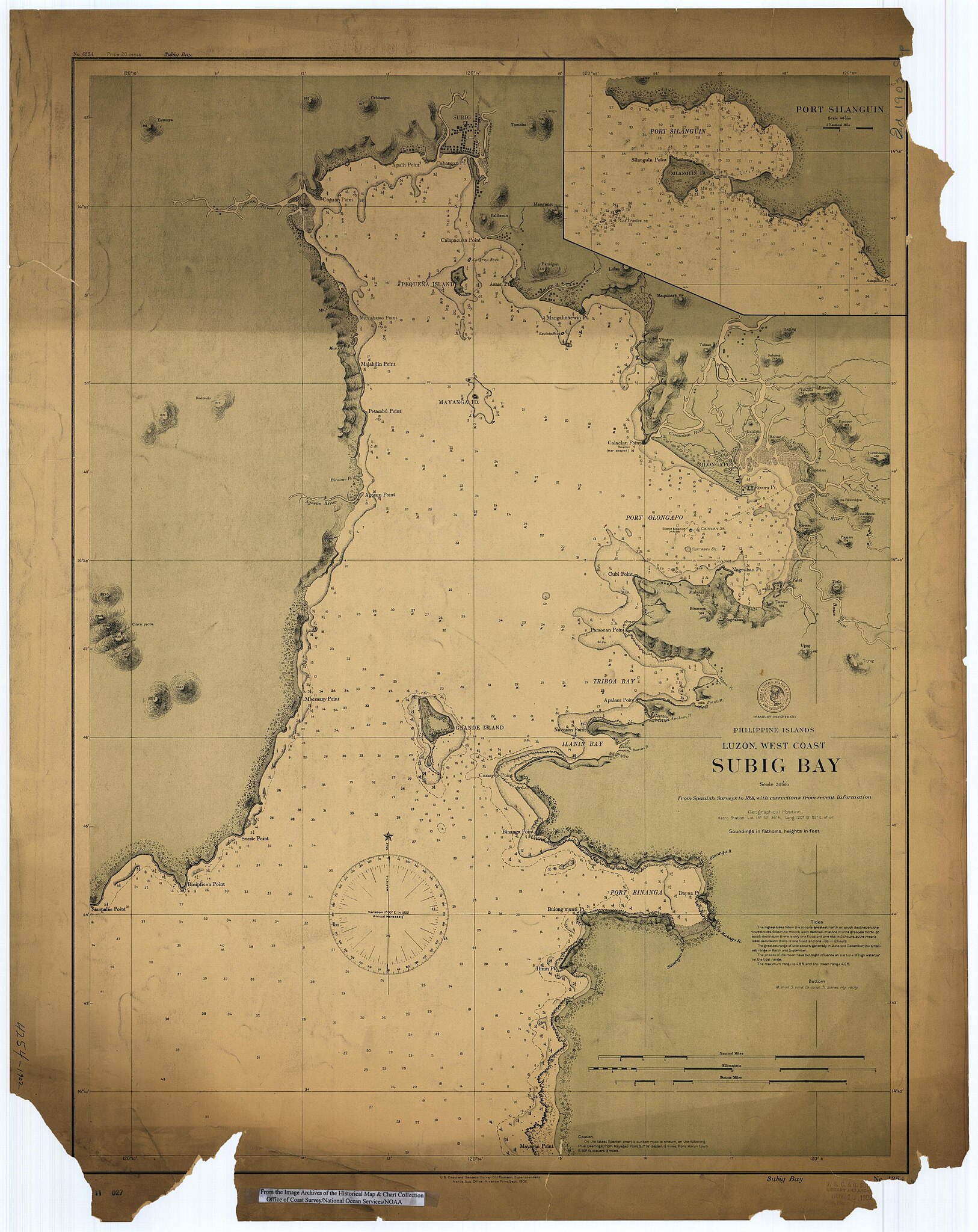
Scanned image of US Coast & Geodetic Survey Manila Office nautical chart #4254 Subig (Subic) Bay, Luzon, Philippines, 1902.
From the Image Archives of the Historical Map & Chart Collection copie d'archive sur Wayback Machine/Office of Coast Survey/National Ocean Service/NOAA/United States government. Converted from MrSID to JPEG format for upload to Commons.
_4254,_by_Manila_Sub_Office,_United_States_Coast_and_Geodetic_Survey_(cropped).jpg)
_Luzon,_Philippines_nautical_chart_4254,_by_Manila_Sub_Office,_United_States_Coast_and_Geodetic_Survey.jpg?uselang=fr)
Conditions d’utilisation
Cette image est dans le domaine public car son contenu provient de la
National Oceanic and Atmospheric Administration , réalisé par un employé dans le cadre de ses activités professionnelles.
|
Historique du fichier
Cliquer sur une date et heure pour voir le fichier tel qu'il était à ce moment-là.
| Date et heure | Vignette | Dimensions | Utilisateur | Commentaire | |
|---|---|---|---|---|---|
| actuel | 17 mars 2006 à 03:02 | | 2 672 × 3 366 (1,21 Mio) | Cdc~commonswiki | Scanned image of US Coast & Geodetic Survey Manila Office nautical chart #4254 Subig (Subic) Bay, Luzon, Philippines, 1902. From the Image Archives of the [http://chartmaker.ncd.noaa.gov/csdl/ctp/abstract.htm Historical Map & Chart Collection]/Office of |
Utilisation du fichier
La page suivante utilise ce fichier :
Usage global du fichier
Les autres wikis suivants utilisent ce fichier :
- Utilisation sur ast.wikipedia.org
- Utilisation sur da.wikipedia.org
- Utilisation sur en.wikipedia.org
- Utilisation sur es.wikipedia.org
- Utilisation sur id.wikipedia.org
- Utilisation sur ja.wikipedia.org
- Utilisation sur nl.wikipedia.org
- Utilisation sur no.wikipedia.org
- Utilisation sur pt.wikipedia.org
- Utilisation sur ru.wikipedia.org
- Utilisation sur sv.wikipedia.org
- Utilisation sur tl.wikipedia.org
- Utilisation sur vi.wikipedia.org
- Utilisation sur www.wikidata.org
- Utilisation sur zh.wikipedia.org
_Luzon,_Philippines_nautical_chart_4254,_by_Manila_Sub_Office,_United_States_Coast_and_Geodetic_Survey.jpg)