
Fichier:85mapmacedonia.jpg
Fichier d’origine (2 000 × 1 663 pixels, taille du fichier : 2,25 Mio, type MIME : image/jpeg)
Ce fichier et sa description proviennent de Wikimedia Commons.

|
This map has been uploaded by Electionworld from en.wikipedia.org to enable the |
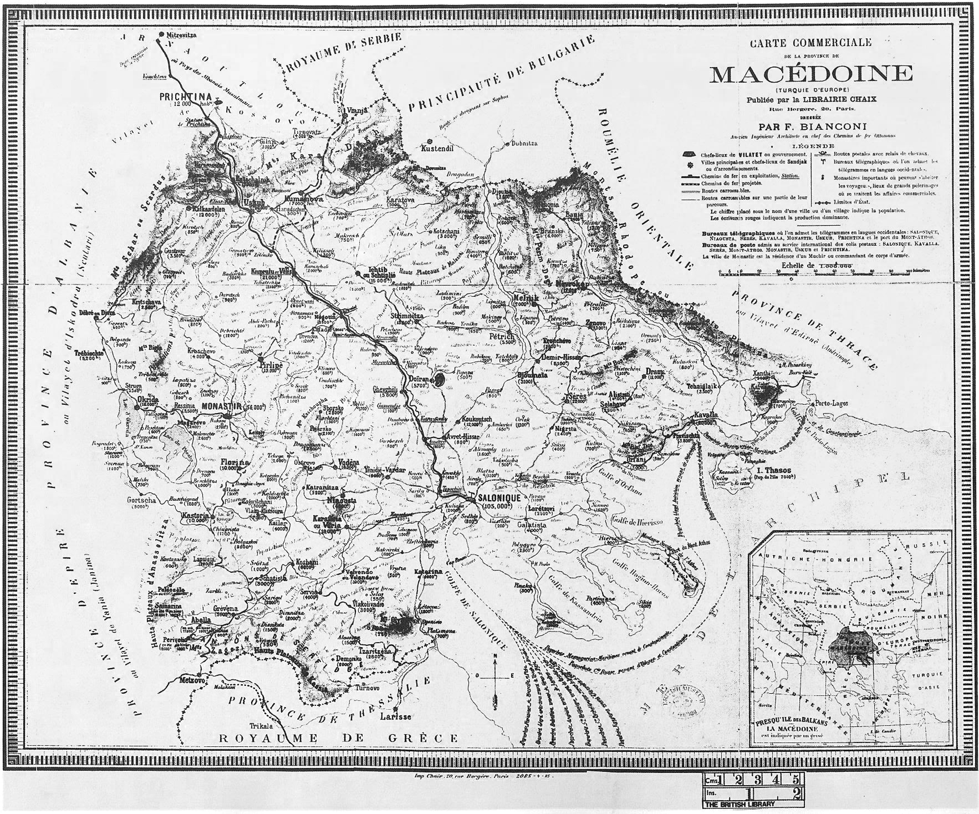
Map of Macedonia by F.Bianconi Paris, 1885
|
Cette œuvre est également dans le domaine public dans tous les pays pour lesquels le droit d’auteur a une durée de vie de 70 ans ou moins après la mort de l’auteur.
| |
| Ce fichier a été identifié comme étant exempt de restrictions connues liées au droit d’auteur, y compris tous les droits connexes et voisins. | |
Historique du fichier
Cliquer sur une date et heure pour voir le fichier tel qu'il était à ce moment-là.
| Date et heure | Vignette | Dimensions | Utilisateur | Commentaire | |
|---|---|---|---|---|---|
| actuel | 6 octobre 2014 à 18:26 | | 2 000 × 1 663 (2,25 Mio) | Enter514 | Larger version of the map: Province of Macedonia (European Turkey) by F.Bianconi Paris, 1885. |
| 1 août 2012 à 19:39 |  | 936 × 690 (458 kio) | Mallowtek | 1° rotation as required | |
| 25 avril 2012 à 22:09 |  | 952 × 707 (485 kio) | McZusatz | greyscale | |
| 20 décembre 2006 à 22:20 |  | 952 × 707 (282 kio) | Electionworld | {{ew|en|Makedonia}} Map of Macedonia by F.Bianconi Paris, 1885 {{PD-old-50}} Category:Maps of the history of the Republic of Macedonia Category:Maps of the history of Greece Category:Maps of the history of Bulgaria [[Category:Old maps of the |
Utilisation du fichier
La page suivante utilise ce fichier :
Usage global du fichier
Les autres wikis suivants utilisent ce fichier :
- Utilisation sur be.wikipedia.org
- Utilisation sur el.wikipedia.org
- Utilisation sur en.wikipedia.org
- Utilisation sur es.wikipedia.org
- Utilisation sur gl.wikipedia.org
- Utilisation sur ja.wikipedia.org
- Utilisation sur ko.wikipedia.org
- Utilisation sur tr.wikipedia.org
- Utilisation sur uk.wikipedia.org
- Utilisation sur www.wikidata.org
- Utilisation sur zh.wikipedia.org