
Fichier:Autobahn Notlandeplatz A29 Ahlhorn DoD DF-ST-85-05075.jpg
Taille de cet aperçu : 434 × 599 pixels. Autres résolutions : 174 × 240 pixels | 348 × 480 pixels | 556 × 768 pixels | 742 × 1 024 pixels | 1 878 × 2 593 pixels.
Fichier d’origine (1 878 × 2 593 pixels, taille du fichier : 3,36 Mio, type MIME : image/jpeg)
Ce fichier et sa description proviennent de Wikimedia Commons.
Description
| Description |
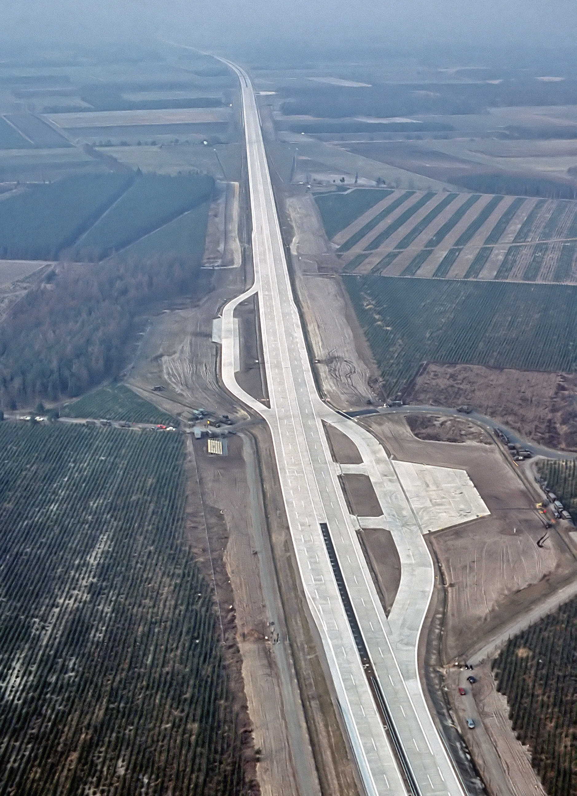
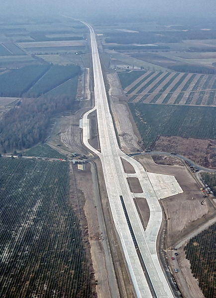
English: An aerial view of the autobahn A29 near Ahlhorn, Germany. Construction of A29 completed in 1984, the emergency-runway had been in the initial design. The highway had been cleared of traffic to allow it to be used to land aircraft during NATO exercise "highway 84".
Deutsch: Luftbild der Bundesautobahn A29 in der Nähe von Ahlhorn im Jahr ihrer Fertigstellung. Im Rahmen der Nato-Übung "Highway 84" wurde der Notlandeplatz genutzt. |
|||
| Date | ||||
| Source |
|
|||
| Auteur | TSgt. Rod Prouty, USAF | |||
| Autorisation (Réutilisation de ce fichier) |
Released to Public Photo ID:DF-ST-85-05075 |
| Lieu de la prise de vue | | Voir cet endroit et d’autres images sur : OpenStreetMap |
|---|
Conditions d’utilisation
Cette image ou ce fichier est un travail réalisé par un aviateur ou un employé de l'U.S. Air Force, pris ou fait dans le cadre des fonctions officielles de cette personne. En tant que travail du Gouvernement fédéral des États-Unis, cette image ou ce fichier est dans le domaine public.
|
 |
Historique du fichier
Cliquer sur une date et heure pour voir le fichier tel qu'il était à ce moment-là.
| Date et heure | Vignette | Dimensions | Utilisateur | Commentaire | |
|---|---|---|---|---|---|
| actuel | 4 août 2007 à 08:12 | | 1 878 × 2 593 (3,36 Mio) | -jha- | {{Information |Description={{en|An aerial view of the autobahn A29 near Ahlhorn. construction of A29 just completed in 1984, the emergency-runway has been in the initial design. The highway has been cleared of traffic to allow it to be used to land aircr |
Utilisation du fichier
Les 2 pages suivantes utilisent ce fichier :
Usage global du fichier
Les autres wikis suivants utilisent ce fichier :
- Utilisation sur de.wikipedia.org
- Utilisation sur de.wikivoyage.org
- Utilisation sur en.wikipedia.org
- Utilisation sur fa.wikipedia.org
- Utilisation sur fy.wikipedia.org
- Utilisation sur he.wikipedia.org
- Utilisation sur hu.wikipedia.org
- Utilisation sur it.wikipedia.org
- Utilisation sur ja.wikipedia.org
- Utilisation sur nds.wikipedia.org
- Utilisation sur nl.wikipedia.org
- Utilisation sur pl.wikipedia.org
- Utilisation sur sv.wikipedia.org
- Utilisation sur th.wikipedia.org
- Utilisation sur tr.wikipedia.org
- Utilisation sur zh.wikipedia.org