
Fichier:BlankMap-World 1959.svg

Taille de cet aperçu PNG pour ce fichier SVG : 800 × 406 pixels. Autres résolutions : 320 × 162 pixels | 640 × 325 pixels | 1 024 × 520 pixels | 1 280 × 650 pixels | 2 560 × 1 299 pixels | 940 × 477 pixels.
Fichier d’origine (Fichier SVG, nominalement de 940 × 477 pixels, taille : 794 kio)
Ce fichier et sa description proviennent de Wikimedia Commons.
Description
| Description |
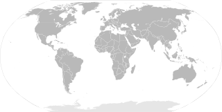
English: SVG Blank map of the world showing 1959 borders
Français : Carte muette du monde montrant les frontières de 1959, au format SVG. |
||
| Date | |||
| Source |
|
||
| Auteur | Sémhur | ||
| Autres versions |
Œuvres dérivées de ce fichier : | ||
| Attribution (imposé par la licence) | © Sémhur / Wikimedia Commons / | ||
| SVG | Cette image vectorielle SVG a été créée avec Inkscape .
|
||
| Graphic Lab |

| Blank maps of the world for historical use | |
| pre-1800 | |
|
19th century | |
|
20th century | |
|
1902 · 1912 · 1914 · WWI · Aug 1918 · 1920 · 1921 · 1924 · 1926 · 1935 · 1937 · Mar 1938 · Oct 1938 · Mar 1939 · Oct 1939 · WWII · Nov 1942 · May 1945 · 1957 · 1959 · 1962 · 1968 · 1970 · 1985 · 1990 · 1993 | |
|
21st century | |
| (this template: · view · discuss ) | |
.PNG)
Conditions d’utilisation
Moi, en tant que détenteur des droits d’auteur sur cette œuvre, je la publie sous les licences suivantes :
| Copyleft : cette œuvre d’art est libre ; vous pouvez la redistribuer ou la modifier selon les termes de la licence Art Libre. Vous trouverez un exemplaire de cette licence sur le site Copyleft Attitude ainsi que sur d’autres sites. |
This file is licensed under the Creative Commons Attribution-Share Alike Attribution-Share Alike 4.0 International, 3.0 Unported, 2.5 Generic, 2.0 Generic and 1.0 Generic license.
- Vous êtes libre :
- de partager – de copier, distribuer et transmettre cette œuvre
- d’adapter – de modifier cette œuvre
- Sous les conditions suivantes :
- paternité – Vous devez donner les informations appropriées concernant l'auteur, fournir un lien vers la licence et indiquer si des modifications ont été faites. Vous pouvez faire cela par tout moyen raisonnable, mais en aucune façon suggérant que l’auteur vous soutient ou approuve l’utilisation que vous en faites.
- partage à l’identique – Si vous modifiez, transformez, ou vous basez sur cette œuvre, vous devez distribuer votre contribution sous la même licence ou une licence compatible avec celle de l’original.
Vous pouvez choisir l’une de ces licences.
Historique du fichier
Cliquer sur une date et heure pour voir le fichier tel qu'il était à ce moment-là.
| Date et heure | Vignette | Dimensions | Utilisateur | Commentaire | |
|---|---|---|---|---|---|
| actuel | 2 juin 2014 à 12:20 | | 940 × 477 (794 kio) | Sémhur | Valid SVG ; separate southern Ryukyu Island from Japan |
| 25 mai 2008 à 10:14 |  | 940 × 477 (793 kio) | Sémhur | Group Pakistan and East-Pakistan (not yet Bangladesh in 1959) | |
| 14 avril 2008 à 19:16 |  | 940 × 477 (793 kio) | Sémhur | the bitmap... one more time | |
| 14 avril 2008 à 19:10 |  | 940 × 477 (794 kio) | Sémhur | {{Information |Description= {{en|SVG Blank map of the world showing 1959 borders.}} {{fr|Carte muette du monde montrant les frontières de 1959, au format SVG.}} |Source= * Image:BlankMap-World6.svg by {{u|Canuckguy}}, under licence Public Domain * [ |
Utilisation du fichier
La page suivante utilise ce fichier :
Usage global du fichier
Les autres wikis suivants utilisent ce fichier :
- Utilisation sur en.wikipedia.org
- Utilisation sur ko.wikipedia.org
- Utilisation sur nl.wikipedia.org