
Fichier:ISS-30 Lake Fitri, Chad.jpg
Taille de cet aperçu : 800 × 531 pixels. Autres résolutions : 320 × 213 pixels | 640 × 425 pixels | 1 024 × 680 pixels | 1 280 × 850 pixels | 2 560 × 1 700 pixels | 4 288 × 2 848 pixels.
Fichier d’origine (4 288 × 2 848 pixels, taille du fichier : 6,37 Mio, type MIME : image/jpeg)
Ce fichier et sa description proviennent de Wikimedia Commons.
Description
| Description |
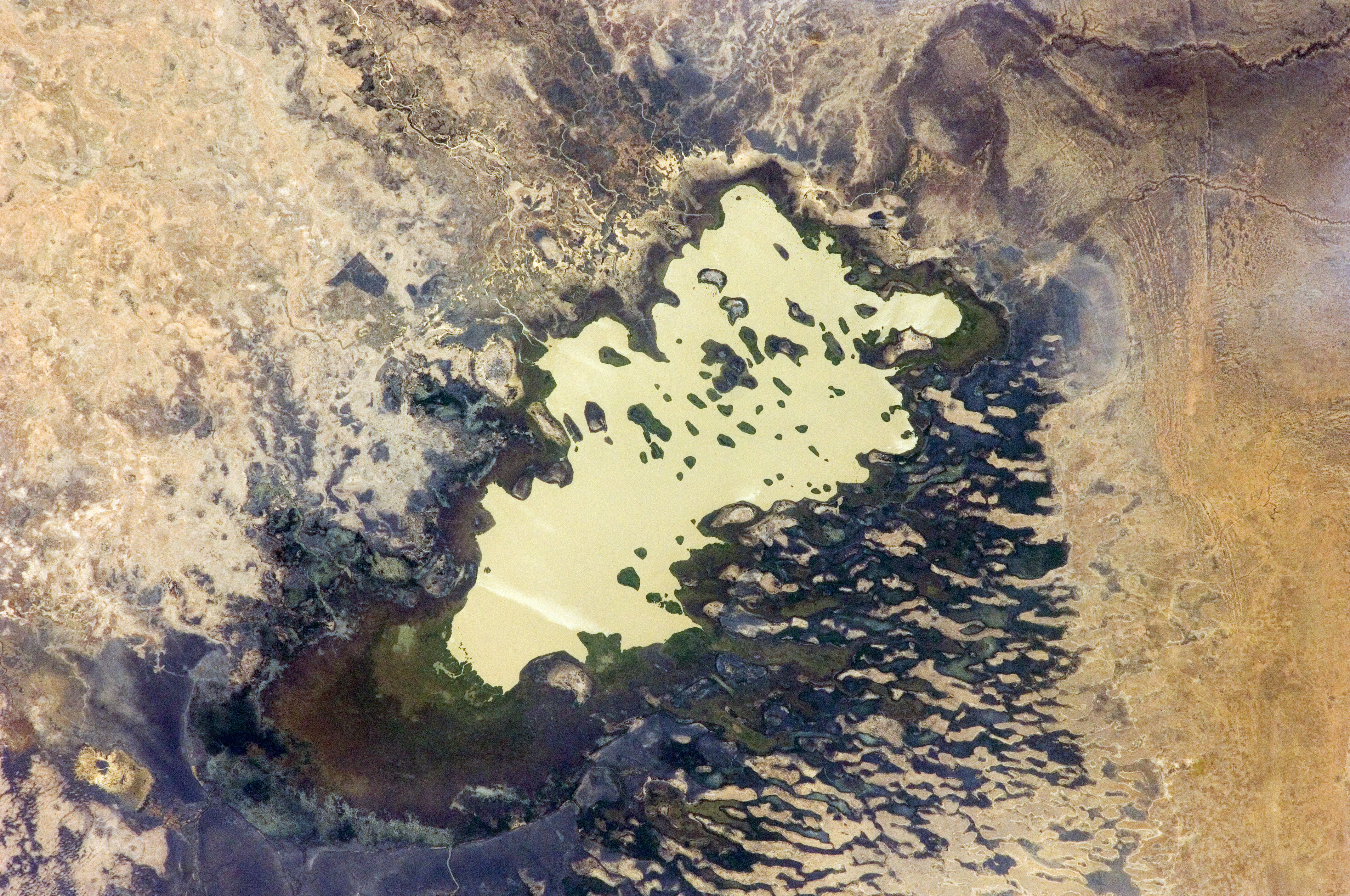
English: Lake Fitri, Chad is featured in this image photographed by an Expedition 30 crew member on the International Space Station.
|
| Date | |
| Source | http://spaceflight.nasa.gov/gallery/images/station/crew-30/html/iss030e059398.html |
| Auteur | NASA |
Cette image ou vidéo a été cataloguée par le Johnson Space Center de la National Aeronautics and Space Administration (NASA) des États-Unis sous Photo ID : ISS030-E-059398.Ce bandeau n’indique rien sur le statut de l’œuvre au regard du droit d'auteur. Un bandeau de droit d’auteur est requis. Voir Commons:À propos des licences pour plus d’informations. Autres langues :
|
Conditions d’utilisation
"The Gateway to Astronaut Photography of Earth". Image provenant du Laboratoire d'Analyse et d'Imagerie des Sciences, Centre Spatial Johnson de la NASA.
Source de la photo : ISS030-E-59398.
|
Historique du fichier
Cliquer sur une date et heure pour voir le fichier tel qu'il était à ce moment-là.
| Date et heure | Vignette | Dimensions | Utilisateur | Commentaire | |
|---|---|---|---|---|---|
| actuel | 20 avril 2016 à 22:00 | | 4 288 × 2 848 (6,37 Mio) | Ras67 | new rendered in high quality from NASA's raw image data |
| 4 juin 2012 à 14:46 |  | 4 288 × 2 848 (2,03 Mio) | Ras67 | levels | |
| 21 février 2012 à 19:59 |  | 4 288 × 2 848 (1,76 Mio) | Ras67 | {{Information |Description ={{en|1=Lake Fitri, Chad is featured in this image photographed by an Expedition 30 crew member on the International Space Station. Lake Fitri is an endorheic, or terminal lake in a desert basin in the southern Sahara Desert. |
Utilisation du fichier
Les 2 pages suivantes utilisent ce fichier :
Usage global du fichier
Les autres wikis suivants utilisent ce fichier :
- Utilisation sur ar.wikipedia.org
- Utilisation sur arz.wikipedia.org
- Utilisation sur be.wikipedia.org
- Utilisation sur cv.wikipedia.org
- Utilisation sur de.wikipedia.org
- Utilisation sur el.wikipedia.org
- Utilisation sur en.wikipedia.org
- Utilisation sur es.wikipedia.org
- Utilisation sur id.wikipedia.org
- Utilisation sur it.wikipedia.org
- Utilisation sur ka.wikipedia.org
- Utilisation sur lt.wikipedia.org
- Utilisation sur my.wikipedia.org
- Utilisation sur nl.wikipedia.org
- Utilisation sur pl.wikipedia.org
- Utilisation sur ru.wikipedia.org
- Utilisation sur uk.wikipedia.org
- Utilisation sur vi.wikipedia.org
- Utilisation sur www.wikidata.org