
Fichier:Kerch strait bridge map.svg

Taille de cet aperçu PNG pour ce fichier SVG : 768 × 600 pixels. Autres résolutions : 308 × 240 pixels | 615 × 480 pixels | 984 × 768 pixels | 1 280 × 999 pixels | 2 560 × 1 999 pixels | 821 × 641 pixels.
Fichier d’origine (Fichier SVG, nominalement de 821 × 641 pixels, taille : 225 kio)
Ce fichier et sa description proviennent de Wikimedia Commons.
Description
| Description |
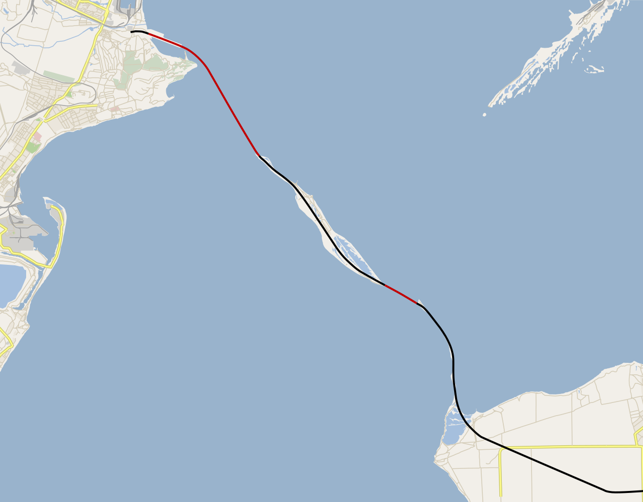
Русский: Карта нового моста через Керченский пролив (пока только заготовка карты).
Части моста, располагающиеся полностью над водой.
Части моста, располагающиеся полностью над сушей (Тузлинская коса). English: Kerch Strait bridge map, WIP.
Above-water parts of the bridge.
Above-surface parts of the bridge (Tuzla Spit). |
|||||||||
| Date | ||||||||||
| Source | Travail personnel using Maperitive and Inkscape, based on OpenStreetMap data. | |||||||||
| Créé par | ||||||||||
| Données géotemporelles | ||||||||||
| Rectangle englobant |
|
|||||||||
| Géoréférencement | Si c'est inapproprié, définissez warp_status = skip pour masquer. | |||||||||
Conditions d’utilisation
Moi, en tant que détenteur des droits d’auteur sur cette œuvre, je la publie sous la licence suivante :
Ce fichier est sous la licence Creative Commons Attribution – Partage dans les Mêmes Conditions 4.0 International.
- Vous êtes libre :
- de partager – de copier, distribuer et transmettre cette œuvre
- d’adapter – de modifier cette œuvre
- Sous les conditions suivantes :
- paternité – Vous devez donner les informations appropriées concernant l'auteur, fournir un lien vers la licence et indiquer si des modifications ont été faites. Vous pouvez faire cela par tout moyen raisonnable, mais en aucune façon suggérant que l’auteur vous soutient ou approuve l’utilisation que vous en faites.
- partage à l’identique – Si vous modifiez, transformez, ou vous basez sur cette œuvre, vous devez distribuer votre contribution sous la même licence ou une licence compatible avec celle de l’original.
Historique du fichier
Cliquer sur une date et heure pour voir le fichier tel qu'il était à ce moment-là.
| Date et heure | Vignette | Dimensions | Utilisateur | Commentaire | |
|---|---|---|---|---|---|
| actuel | 1 juin 2017 à 15:04 | | 821 × 641 (225 kio) | Nzeemin | updated OSM background |
| 16 avril 2016 à 23:22 |  | 821 × 641 (168 kio) | Nzeemin | Updated bridgeline and roads | |
| 22 décembre 2015 à 20:16 |  | 821 × 641 (167 kio) | Nzeemin | More fixes. | |
| 17 décembre 2015 à 15:52 |  | 821 × 641 (170 kio) | Nzeemin | Fixed the bridgeline and roadline. | |
| 27 août 2015 à 18:38 |  | 821 × 641 (170 kio) | Nzeemin | Line split to bridges and roads. | |
| 26 août 2015 à 21:43 |  | 821 × 641 (163 kio) | Nzeemin | User created page with UploadWizard |
Utilisation du fichier
Les 2 pages suivantes utilisent ce fichier :
Usage global du fichier
Les autres wikis suivants utilisent ce fichier :
- Utilisation sur cs.wikipedia.org
- Utilisation sur eo.wikipedia.org
- Utilisation sur fi.wikipedia.org
- Utilisation sur hu.wikipedia.org
- Utilisation sur ru.wikipedia.org
- Utilisation sur sv.wikipedia.org
- Utilisation sur uk.wikiquote.org
- Utilisation sur www.wikidata.org