
Fichier:Los Alamos aerial view.jpeg

Fichier d’origine (1 435 × 1 153 pixels, taille du fichier : 757 kio, type MIME : image/jpeg)
Ce fichier et sa description proviennent de Wikimedia Commons.
Description
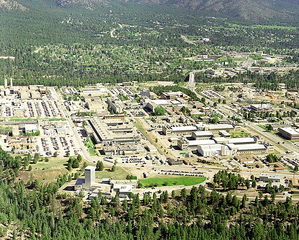
| Description | Aerial view of Los Alamos National Laboratory, "1995 aerial TA-3 south to north". |
| Source | http://www.lanl.gov/worldview/news/photos/aerials.shtml |
| Auteur | Los Alamos National Laboratory |
| Position de l'objet | | Voir cet endroit et d’autres images sur : OpenStreetMap |
|---|
|
Ceci est une photographie d’un monument référencé dans le National Register of Historic Places des États-Unis sous le numéro 66000893. |

|
Les informations concernant les droits d'auteur, par exemple le nom de l'auteur, son email, son site internet ou sa signature, qui étaient visibles sur le document lui-même, ont été déplacées dans les métadonnées du document ou sur sa page de description. Ainsi, l'image est plus facilement réutilisable, l'information n'est pas restreinte à une langue particulière et il est plus facile de modifier ou rechercher l'information. Wikimedia Commons déconseille fortement l'incrustation visible d'informations dans les images ; si vous ne souhaitez pas que cette image soit utilisée sans cette information incrustée, si elle n'est pas dans le domaine public ou sous des termes libres, vous pouvez demander à ce qu'elle soit supprimée.
|
Conditions d’utilisation

|
This image comes from Los Alamos National Laboratory, a national laboratory privately operated under contract from the United States Department of Energy by Los Alamos National Security, LLC between October 1, 2007 and October 31, 2018. LANL allowed anyone to use it for any purpose, provided that the copyright holder is properly attributed. Redistribution, derivative work, commercial use, and all other use is permitted. LANL requires the following text be used when crediting images to it: (link)
Unless otherwise indicated, this information has been authored by an employee or employees of the Los Alamos National Security, LLC (LANS), operator of the Los Alamos National Laboratory under Contract No. DE-AC52-06NA25396 with the U.S. Department of Energy. The U.S. Government has rights to use, reproduce, and distribute this information. The public may copy and use this information without charge, provided that this Notice and any statement of authorship are reproduced on all copies. Neither the Government nor LANS makes any warranty, express or implied, or assumes any liability or responsibility for the use of this information. |
|
Historique du fichier
Cliquer sur une date et heure pour voir le fichier tel qu'il était à ce moment-là.
| Date et heure | Vignette | Dimensions | Utilisateur | Commentaire | |
|---|---|---|---|---|---|
| actuel | 26 juin 2011 à 16:22 | | 1 435 × 1 153 (757 kio) | Keraunoscopia | removed watermark |
| 8 mai 2005 à 11:18 |  | 1 435 × 1 153 (750 kio) | Floriang | Aerial view of Los Alamos National Laboratory, "1995 aerial TA-3 south to north", from http://www.lanl.gov/worldview/news/photos/aerials.shtml ''Source:'' en.wikipedia.org, upload by Fastfission {{PD-USGov}} [[Category:Bi |
Utilisation du fichier
Les 3 pages suivantes utilisent ce fichier :
Usage global du fichier
Les autres wikis suivants utilisent ce fichier :
- Utilisation sur ar.wikipedia.org
- Utilisation sur bg.wikipedia.org
- Utilisation sur bn.wikipedia.org
- Utilisation sur bo.wikipedia.org
- Utilisation sur br.wikipedia.org
- Utilisation sur ca.wikipedia.org
- Utilisation sur cs.wikipedia.org
- Utilisation sur da.wikipedia.org
- Utilisation sur de.wikipedia.org
- Utilisation sur el.wikipedia.org
- Utilisation sur en.wikipedia.org
- Fermi paradox
- Los Alamos National Laboratory
- Theodore Hall
- Bechtel
- Albuquerque–Santa Fe–Los Alamos combined statistical area
- List of National Historic Landmarks in New Mexico
- National Register of Historic Places listings in Los Alamos County, New Mexico
- User:CM at Bechtel/Major projects table
- Draft:Triad National Security
- Utilisation sur en.wikiversity.org
- Utilisation sur eo.wikipedia.org
- Utilisation sur es.wikipedia.org
- Utilisation sur et.wikipedia.org
- Utilisation sur eu.wikipedia.org
- Utilisation sur fa.wikipedia.org
- Utilisation sur fi.wikipedia.org
- Utilisation sur gl.wikipedia.org
- Utilisation sur ha.wikipedia.org
- Utilisation sur he.wikipedia.org
- Utilisation sur hy.wikipedia.org
Voir davantage sur l’utilisation globale de ce fichier.