
Fichier:Map of the Territorial Waters of the Atlantic and Indian Ocean.png

Taille de cet aperçu : 800 × 459 pixels. Autres résolutions : 320 × 184 pixels | 640 × 367 pixels | 1 024 × 588 pixels | 1 280 × 735 pixels | 2 919 × 1 676 pixels.
Fichier d’origine (2 919 × 1 676 pixels, taille du fichier : 588 kio, type MIME : image/png)
Ce fichier et sa description proviennent de Wikimedia Commons.

|
Cette image (de type carte) devrait être recréée dans un format vectoriel, en tant que fichier SVG. Cela offrirait plusieurs avantages : voir Commons:Media for cleanup pour plus d'informations. Si une version SVG de cette image est déjà disponible, merci de bien vouloir l'envoyer. Après cela, remplacez ce modèle par {{vector version available|nouveau nom d'image.svg}}.
|
Description
| Description |
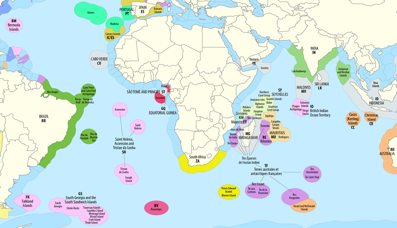
Deutsch: Ausschließliche Wirtschaftszonen (EEZ) im Atlantischen und im Indischen Ozean
English: Territorial waters (EEZ) of the Atlantic and Indian Ocean |
| Date | see file history |
| Source | Travail personnel avec: this map by B1mbo |
| Auteur | Maximilian Dörrbecker (Chumwa) |
| Autorisation (Réutilisation de ce fichier) |
Moi, en tant que détenteur des droits d’auteur sur cette œuvre, je la publie sous la licence suivante : Ce fichier est disponible selon les termes de la licence Creative Commons Attribution – Partage dans les Mêmes Conditions 2.5 Générique
Sie dürfen das Bild zu den folgenden Bedingungen nutzen:
|
| Autres versions |
|


Historique du fichier
Cliquer sur une date et heure pour voir le fichier tel qu'il était à ce moment-là.
| Date et heure | Vignette | Dimensions | Utilisateur | Commentaire | |
|---|---|---|---|---|---|
| actuel | 2 mai 2023 à 11:06 | | 2 919 × 1 676 (588 kio) | Lasunncty | Comoros not part of France |
| 4 octobre 2018 à 07:46 |  | 2 919 × 1 676 (799 kio) | Chumwa | corr | |
| 29 août 2018 à 21:18 |  | 2 919 × 1 676 (797 kio) | Chumwa | {{Information |Description= {{de|1=Ausschließliche Wirtschaftszonen (EEZ) im Atlantischen und im Indischen Ozean}} {{en|1=Territorial waters (EEZ) of the Atlantic and Indian Ocean}} |Source = {{own using}} this map by {{U|B1mbo}} |Date = see file history |Author = Maximilian Dörrbecker (Chumwa) |Permission={{self|cc-by-sa-2.5}} Sie dürfen das Bild zu den folgenden Bedingungen nutzen: * Sie müssen den Namen des... |
Utilisation du fichier
La page suivante utilise ce fichier :
Usage global du fichier
Les autres wikis suivants utilisent ce fichier :
- Utilisation sur af.wikipedia.org
- Utilisation sur ar.wikipedia.org
- Utilisation sur ast.wikipedia.org
- Utilisation sur de.wikipedia.org
- Utilisation sur en.wikipedia.org
- Utilisation sur es.wikipedia.org
- Utilisation sur hi.wikipedia.org
- Utilisation sur it.wikipedia.org
- Utilisation sur ja.wikipedia.org
- Utilisation sur ru.wikipedia.org
- Utilisation sur te.wikipedia.org