
Fichier:Naruto map.jpg

Taille de cet aperçu : 800 × 460 pixels. Autres résolutions : 320 × 184 pixels | 640 × 368 pixels | 1 024 × 589 pixels | 1 280 × 737 pixels | 2 560 × 1 473 pixels | 10 738 × 6 180 pixels.
Fichier d’origine (10 738 × 6 180 pixels, taille du fichier : 34,06 Mio, type MIME : image/jpeg)
Ce fichier et sa description proviennent de Wikimedia Commons.
| Avertissement | Certains navigateurs peuvent avoir des difficultés à afficher cette image à sa résolution complète : elle possède un nombre de pixels singulièrement élevé et peut ne pas se charger correctement ou faire planter votre navigateur. |
|---|
| Description |
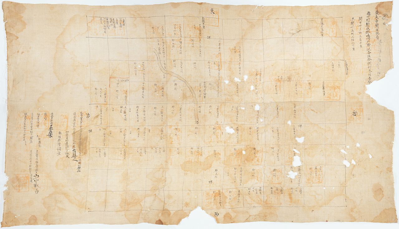
English: Map of rice fields in Naruto (today central Takaoka), a former manor of Tōdai-ji. The map had been in the possession of Tōdai-ji. unbound, ink and light color on linen cloth, 79.8 × 140.5 cm (31.4 × 55.3 in) |
|||||
| Date | ||||||
| Source | Emuseum | |||||
| Auteur | Auteur inconnu | |||||
| Autorisation (Réutilisation de ce fichier) |
|
|||||
Historique du fichier
Cliquer sur une date et heure pour voir le fichier tel qu'il était à ce moment-là.
| Date et heure | Vignette | Dimensions | Utilisateur | Commentaire | |
|---|---|---|---|---|---|
| actuel | 16 octobre 2011 à 12:27 | | 10 738 × 6 180 (34,06 Mio) | Bamse | {{Information |Description={{en|1=Map of rice fields in Naruto (today central Takaoka), a former manor of Tōdai-ji. The map had been in the possession of Tōdai-ji. unbound, ink and light color on linen cloth, 79.8 × 140.5 cm (31.4 × 55.3 in)}} |Source |
Utilisation du fichier
Les 2 pages suivantes utilisent ce fichier :
Usage global du fichier
Les autres wikis suivants utilisent ce fichier :
- Utilisation sur en.wikipedia.org
- Utilisation sur es.wikipedia.org
- Utilisation sur ja.wikipedia.org
- Utilisation sur pt.wikipedia.org
- Utilisation sur zh.wikipedia.org