
Fichier:SanFranCity2.jpg
Fichier d’origine (1 043 × 831 pixels, taille du fichier : 187 kio, type MIME : image/jpeg)
Ce fichier et sa description proviennent de Wikimedia Commons.
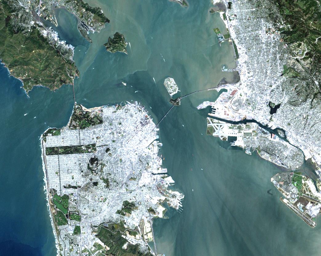
URL: http://visibleearth.nasa.gov/view_rec.php?id=133
Credit: Image courtesy EROS Data Center
On a rare fog free day Landsat 7 flew over San Francisco and produced this stunning true color image. You can easily see both man made structures—the Golden Gate Bridge, the Bay Bridge, Alcatraz, and Oakland International Airport—and natural features such as the Marin Headlands and the complex currents in San Francisco Bay.
This image was provided by the EROS Data Center Landsat 7 Data Handling Facility Image Assessment System (IAS). Landsat 7 digital data are not yet available to the general public. Browse, Level 0R and Level 1 data will be made available for retail sale this summer via the EROS Data Center following completion of orbit raising and instrument checkout and calibration.
| Ce fichier provient de la NASA. Sauf exception, les documents créés par la NASA ne sont pas soumis à copyright. Pour plus d'informations, voir la politique de copyright de la NASA. | ||
 |
Attention :
|
Historique du fichier
Cliquer sur une date et heure pour voir le fichier tel qu'il était à ce moment-là.
| Date et heure | Vignette | Dimensions | Utilisateur | Commentaire | |
|---|---|---|---|---|---|
| actuel | 25 août 2005 à 22:28 | | 1 043 × 831 (187 kio) | Nanosmile | URL: http://visibleearth.nasa.gov/view_rec.php?id=133 Credit: Image courtesy EROS Data Center On a rare fog free day Landsat 7 flew over San Francisco and produced this stunning true color image. You can easily see both man made structures—the Golden |
Utilisation du fichier
La page suivante utilise ce fichier :
Usage global du fichier
Les autres wikis suivants utilisent ce fichier :
- Utilisation sur ka.wikipedia.org
- Utilisation sur ro.wikipedia.org
- Utilisation sur ru.wikipedia.org