
Fichier:WigtownshireTraditional.png

Taille de cet aperçu : 535 × 599 pixels. Autres résolutions : 214 × 240 pixels | 428 × 480 pixels | 686 × 768 pixels | 914 × 1 024 pixels | 2 096 × 2 348 pixels.
Fichier d’origine (2 096 × 2 348 pixels, taille du fichier : 152 kio, type MIME : image/png)
Ce fichier et sa description proviennent de Wikimedia Commons.
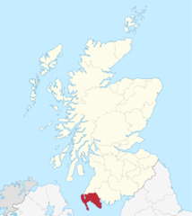
Wigtownshire county
Enlarged version of a map originally drawn by Morwen

|
Vous avez la permission de copier, distribuer et modifier ce document selon les termes de la GNU Free Documentation License version 1.2 ou toute version ultérieure publiée par la Free Software Foundation, sans sections inaltérables, sans texte de première page de couverture et sans texte de dernière page de couverture. Un exemplaire de la licence est inclus dans la section intitulée GNU Free Documentation License. |
| Ce fichier est disponible selon les termes de la licence Creative Commons Attribution – Partage dans les Mêmes Conditions 3.0 (non transposée). | ||
| ||
| Ce bandeau de licence a été ajouté à ce fichier dans le cadre de la procédure de mise à jour des licences des images sous GFDL. |
Historique du fichier
Cliquer sur une date et heure pour voir le fichier tel qu'il était à ce moment-là.
| Date et heure | Vignette | Dimensions | Utilisateur | Commentaire | |
|---|---|---|---|---|---|
| actuel | 3 mai 2015 à 11:13 | | 2 096 × 2 348 (152 kio) | Renamed user OCfxJKu7j2 | Better quality |
| 18 mai 2005 à 18:24 |  | 420 × 520 (12 kio) | Voyager | Wigtownshire county Enlarged version of a map originally drawn by Morwen {{GFDL}} Category:Maps of Scottish traditional counties |
Utilisation du fichier
La page suivante utilise ce fichier :
Usage global du fichier
Les autres wikis suivants utilisent ce fichier :
- Utilisation sur ca.wikipedia.org
- Utilisation sur en.wikipedia.org
- Utilisation sur es.wikipedia.org
- Utilisation sur gd.wikipedia.org
- Siorrachd Bhaile na h-Ùige
- Whithorn
- An t-Sròn Reamhar
- Comhairle Dhùn Phris is Ghall-Ghàidhealaibh
- Càrn Rìoghain
- An Druim Mòr
- Clachan Ghlinn Lus
- Baile Ùr nan Stiùbhartach
- Port Phàdraig
- Baile na h-Ùige
- Teamplaid:Bailtean ann an Siorrachd Bhaile na h-Ùige
- Blaidneach
- Cille Chainneir
- Port Rosnait
- Poll an Iùbhair
- Am Magh Crom
- An Eilreig
- Achadh na Meilge
- Am Monadh Rèidh
- Glaik
- Cill na Tràghad
- Port Neasaig
- Àrd Bhaile
- Cill Chomhghain
- Eaglais Steafain
- Na Lochain
- Lios Uillt
- Cill Choluim
- Ervie
- Sandhead
- Soirbidh
- Baile Gheàrr Lios
- Dùn Reichit
- Whauphill
- Baile Ùr Ghlinn Lus
- Barrachan
- Damnaglaur
- Utilisation sur la.wikipedia.org
- Utilisation sur sh.wikipedia.org