
Fichier:Wisconsin Central 1998 map.png
Taille de cet aperçu : 500 × 599 pixels. Autres résolutions : 200 × 240 pixels | 400 × 480 pixels | 968 × 1 160 pixels.
Fichier d’origine (968 × 1 160 pixels, taille du fichier : 161 kio, type MIME : image/png)
Ce fichier et sa description proviennent de Wikimedia Commons.
Description
| Description |
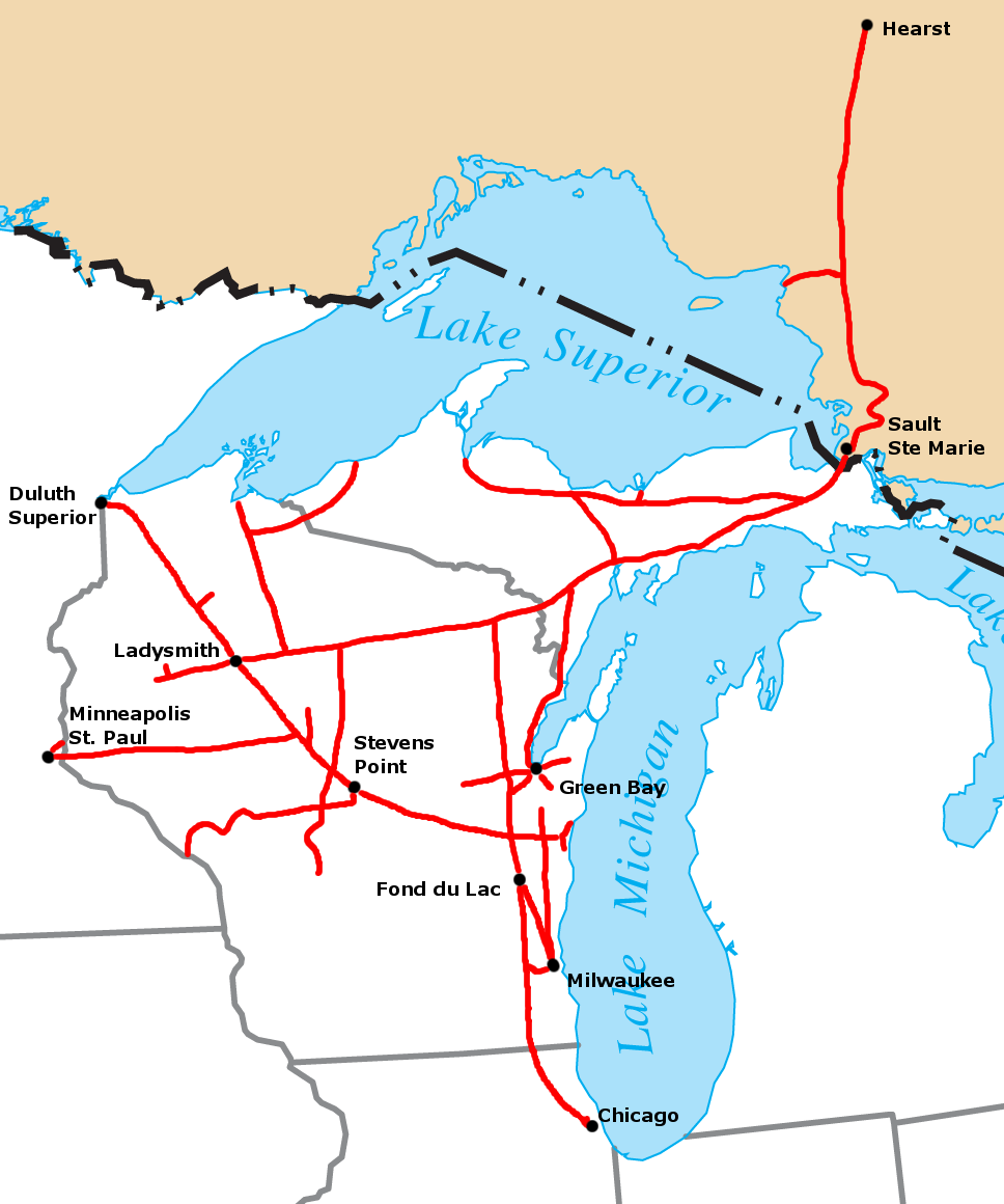
Route map of the Wisconsin Central Railroad operations in North America in 1998. Map created by Sean Lamb (User:Slambo), based on a map in the Wisconsin Central Railroad's 1998 Annual Report. Political boundaries cropped from Image:US_state_outline_map.png, railroad route and city locations and names added using the GIMP. |
| Date | 12 janvier 2006 (date de téléversement originale) |
| Source | La source n’a pas pu être reconnue automatiquement. « Travail personnel » supposé (étant donné la revendication de droit d’auteur). |
| Auteur | L’auteur n’a pas pu être identifié automatiquement. Il est supposé qu'il s'agit de : Slambo (étant donné la revendication de droit d’auteur). |
Conditions d’utilisation
| Moi, propriétaire des droits d’auteur sur cette œuvre, la place dans le domaine public. Ceci s'applique dans le monde entier. Dans certains pays, ceci peut ne pas être possible ; dans ce cas : J’accorde à toute personne le droit d’utiliser cette œuvre dans n’importe quel but, sans aucune condition, sauf celles requises par la loi. |
Historique du fichier
Cliquer sur une date et heure pour voir le fichier tel qu'il était à ce moment-là.
| Date et heure | Vignette | Dimensions | Utilisateur | Commentaire | |
|---|---|---|---|---|---|
| actuel | 13 janvier 2006 à 01:25 | | 968 × 1 160 (161 kio) | Slambo | Route map of the w:Wisconsin Central Railroad operations in w:North America in 1998. Map created by Sean Lamb (User:Slambo), based on a map in the Wisconsin Central Railroad's 1998 Annual Report. Political boundaries cropped from [[Image:U |
Utilisation du fichier
La page suivante utilise ce fichier :
Usage global du fichier
Les autres wikis suivants utilisent ce fichier :
- Utilisation sur de.wikipedia.org
- Utilisation sur en.wikipedia.org
- Utilisation sur ja.wikipedia.org
- Utilisation sur www.wikidata.org