
Fichier:Zebulon Pike Map.PNG

Taille de cet aperçu : 535 × 600 pixels. Autres résolutions : 214 × 240 pixels | 428 × 480 pixels | 685 × 768 pixels | 1 221 × 1 369 pixels.
Fichier d’origine (1 221 × 1 369 pixels, taille du fichier : 3,27 Mio, type MIME : image/png)
Ce fichier et sa description proviennent de Wikimedia Commons.
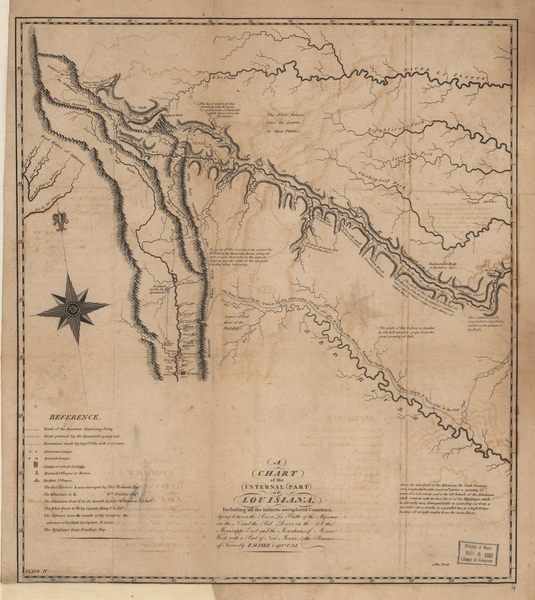
Description
Zebulon Pike's Expedition (1806-1807) : A Chart of the Internal Part of Louisiana from An Account of Expeditions to the Sources of the Mississippi and through the Western Parts of Louisiana . . . . Philadelphia: C. & A. Conrad, 1810
From: A Chart of the Internal Part of Louisiana The Library of Congress
Conditions d’utilisation
| Cette œuvre est issue de la Bibliothèque du Congrès. Selon la bibliothèque, il n'existe aucune restriction connue en matière de droits d'auteur pour l'utilisation de cette œuvre. |  |
Historique du fichier
Cliquer sur une date et heure pour voir le fichier tel qu'il était à ce moment-là.
| Date et heure | Vignette | Dimensions | Utilisateur | Commentaire | |
|---|---|---|---|---|---|
| actuel | 7 juin 2007 à 09:31 | | 1 221 × 1 369 (3,27 Mio) | SalomonCeb | '''Zebulon Pike's Expedition''' (1806-1807) : '' A Chart of the Internal Part of Louisiana'' from An Account of Expeditions to the Sources of the Mississippi and through the Western Parts of Louisiana . . . . Philadelphia: C. & A. Conrad, 1810 From: [htt |
Utilisation du fichier
La page suivante utilise ce fichier :
Usage global du fichier
Les autres wikis suivants utilisent ce fichier :
- Utilisation sur en.wikipedia.org
- Utilisation sur es.wikipedia.org
- Utilisation sur ru.wikipedia.org
- Utilisation sur www.wikidata.org