
Fichier:Nueaton Hinkley 1961 OS.jpg
Taille de cet aperçu : 781 × 600 pixels. Autres résolutions : 313 × 240 pixels | 625 × 480 pixels | 1 000 × 768 pixels | 1 280 × 983 pixels | 2 560 × 1 966 pixels | 6 482 × 4 978 pixels.
Fichier d’origine (6 482 × 4 978 pixels, taille du fichier : 9,98 Mio, type MIME : image/jpeg)
Ce fichier et sa description proviennent de Wikimedia Commons.
Description
| Description |
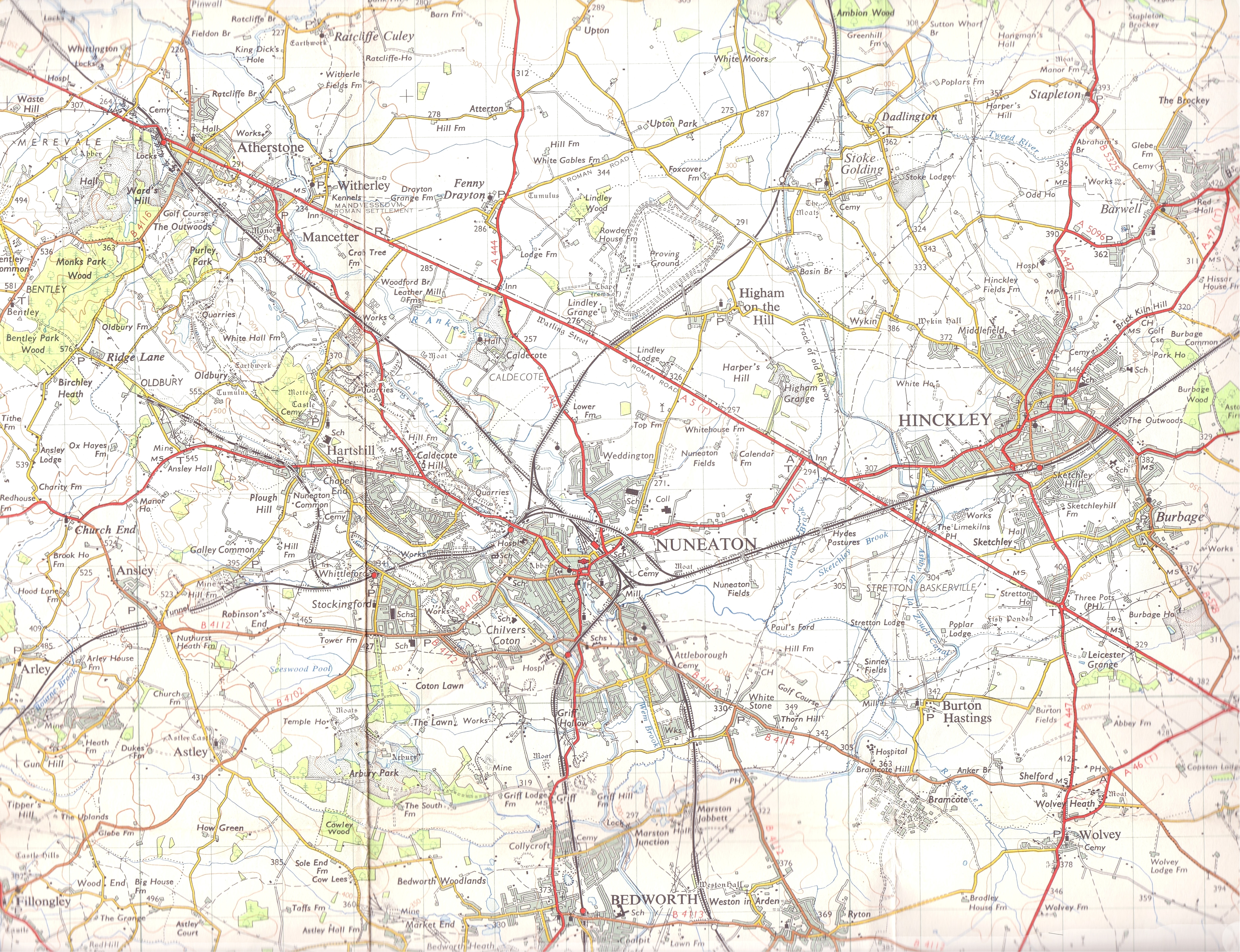
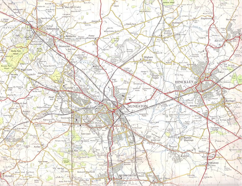
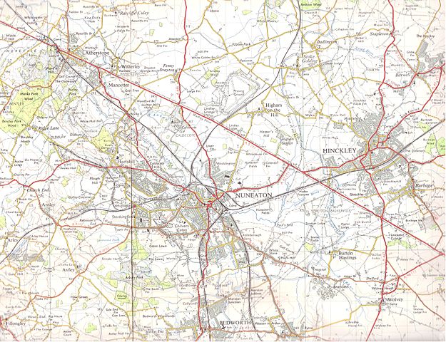
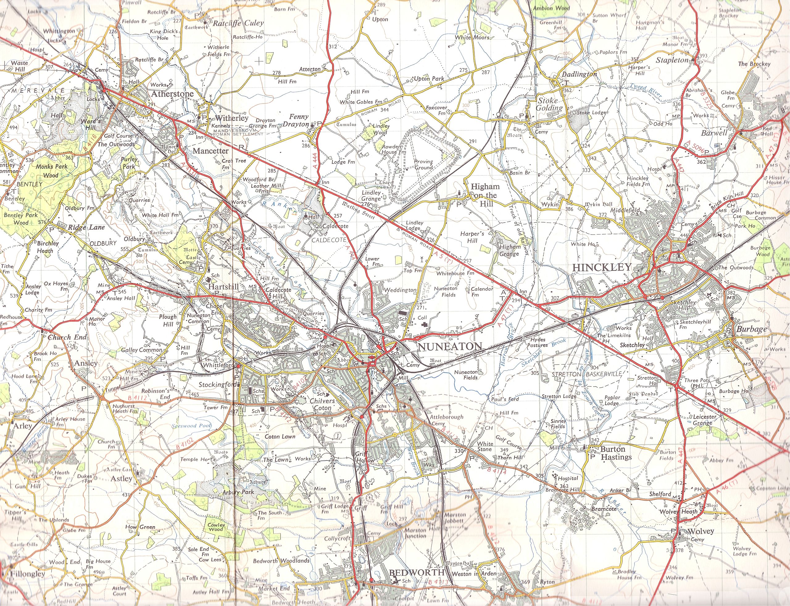
English: A 1961 1 inch = 1 mile series map. Copy right was 50 years and ran out in 2011. It covers Hinkley, Nuneaton, part of Bedworth, Atherstone, Arsley, Burton Hastings, Harts Hill and Wovley. Harts Hill quarry is attached to a railway and in full swing. The coal mines near Griff Lodge Farm and Ansely Hall are in early decline. The mines are now shut and the quarry is (as far as I know) a rubbish-tip. Note the even by then removed railway by Higham Grange and Higham on the Hill. |
| Date | |
| Source | A 1961 1 inch = 1 mile series map. Copy right was 50 years and ran out in 2011. |
| Auteur | Ordinance servery maps, UK |
Conditions d’utilisation
A 1961 1 inch = 1 mile series map. Copy right was 50 years and ran out in 2011.
This work is an Ordnance Survey map over 50 years old, which is covered by Crown Copyright which in this case expires 50 years after publication. Ordnance Survey does however ask that they be credited and that the date of publication be given.
Any ancillary rights gained through the creation of the electronic version are granted as freely usable under any circumstances.
|
Cette œuvre d'art créée par le Gouvernement du Royaume-Uni se trouve dans le domaine public.
Ceci est la conséquence de l'un des points suivants :
Plus d'informations (en anglais). Voir aussi Droit d'auteur et œuvres d'art sous Crown copyright (en anglais).
|
 |
[[Category:Mancetter
Historique du fichier
Cliquer sur une date et heure pour voir le fichier tel qu'il était à ce moment-là.
| Date et heure | Vignette | Dimensions | Utilisateur | Commentaire | |
|---|---|---|---|---|---|
| actuel | 3 mai 2013 à 20:21 | | 6 482 × 4 978 (9,98 Mio) | Wipsenade | User created page with UploadWizard |
Utilisation du fichier
La page suivante utilise ce fichier :
Usage global du fichier
Les autres wikis suivants utilisent ce fichier :
- Utilisation sur azb.wikipedia.org
- Utilisation sur en.wikipedia.org