
Fichier:Relief Map of New Siberian Islands.png
Pas de plus haute résolution disponible.
Relief_Map_of_New_Siberian_Islands.png (675 × 546 pixels, taille du fichier : 304 kio, type MIME : image/png)
Ce fichier et sa description proviennent de Wikimedia Commons.
Description
| Description |
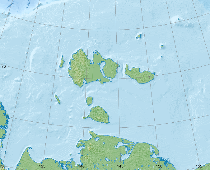
Русский: Новосибирские острова, физическая карта.
|
| Date | |
| Source |
|
| Auteur | Nzeemin |
| Autres versions |
|

Conditions d’utilisation
Moi, en tant que détenteur des droits d’auteur sur cette œuvre, je la publie sous la licence suivante :
Ce fichier est disponible selon les termes de la licence Creative Commons Attribution – Partage dans les Mêmes Conditions 3.0 (non transposée).
- Vous êtes libre :
- de partager – de copier, distribuer et transmettre cette œuvre
- d’adapter – de modifier cette œuvre
- Sous les conditions suivantes :
- paternité – Vous devez donner les informations appropriées concernant l'auteur, fournir un lien vers la licence et indiquer si des modifications ont été faites. Vous pouvez faire cela par tout moyen raisonnable, mais en aucune façon suggérant que l’auteur vous soutient ou approuve l’utilisation que vous en faites.
- partage à l’identique – Si vous modifiez, transformez, ou vous basez sur cette œuvre, vous devez distribuer votre contribution sous la même licence ou une licence compatible avec celle de l’original.
Source Code
set PATH=C:\programs\GMT5\bin;%PATH%
set GSBIN=C:\PROGRA~1\gs\gs9.04/bin

set COORDS=129.8/70.8/163.2/77.5
rem width = xmaxsvg / 150.0 * 2.54
set PAPERX=11.43
rem height = ymaxsvg / 150.0 * 2.54
set PAPERY=9.25
set PROJNCOORDS=-JA143/74.5/4.5i -R%COORDS%r

grdraster 34 -R122/164/70/79 -Gh.grd
grdgradient h.grd -Ne0.3 -A315 -M -Ghi.grd
if not errorlevel 0 goto End

pscoast.exe %PROJNCOORDS% -Gc -Df -P --PAPER_MEDIA=Custom_%PAPERX%cx%PAPERY%c -X0 -Y0 -K > map.eps
grdimage h.grd -Ihi.grd -Cmount.cpt -P %PROJNCOORDS% --PAPER_MEDIA=Custom_%PAPERX%cx%PAPERY%c -X0 -Y0 -O -K >> map.eps
if not errorlevel 0 goto End
pscoast.exe %PROJNCOORDS% -Q -Df -P --PAPER_MEDIA=Custom_%PAPERX%cx%PAPERY%c -X0 -Y0 -O -K >> map.eps

rem grdimage h_cor_cut.grd -Ihi.grd -Cwiki-water-verlauf2.cpt -P %COORDSCUT% --PAPER_MEDIA=Custom_%PAPERX%cx%PAPERY%c -X0 -Y0 -K -O >> map.eps
if not errorlevel 0 goto End

grdcut.exe ETOPO1_Bed_g_gmt4.grd -R122/164/70/79 -Gh_cor_cut.grd
grdgradient h_cor_cut.grd -Ne0.3 -A315 -M -Ghi.grd
if not errorlevel 0 goto End

pscoast %PROJNCOORDS% -Sc -Df -P --PAPER_MEDIA=Custom_%PAPERX%cx%PAPERY%c -X0 -Y0 -O -K >> map.eps
if not errorlevel 0 goto End
grdimage h_cor_cut.grd -Ihi.grd -Cwiki-water-verlauf2.cpt -P %PROJNCOORDS% --PAPER_MEDIA=Custom_%PAPERX%cx%PAPERY%c -X0 -Y0 -K -O >> map.eps
if not errorlevel 0 goto End
rem grdcontour h_cor_cut.grd -C250 -Wc0.2p,#0978AB -P %PROJNCOORDS% --PAPER_MEDIA=Custom_%PAPERX%cx%PAPERY%c -X0 -Y0 -K -O >> map.eps
if not errorlevel 0 goto End
pscoast %PROJNCOORDS% -Q -Df -P --PAPER_MEDIA=Custom_%PAPERX%cx%PAPERY%c -X0 -Y0 -O -K >> map.eps
if not errorlevel 0 goto End

pscoast.exe %PROJNCOORDS% -W0.25,#0978AB -Df -P --PAPER_MEDIA=Custom_%PAPERX%cx%PAPERY%c -X0 -Y0 -O -K >> map.eps

psbasemap %PROJNCOORDS% -Ba5S --PLOT_DEGREE_FORMAT=ddd:mm --ANNOT_FONT_SIZE_PRIMARY=6p -P --MAP_ANNOT_OFFSET_PRIMARY=0 --PAPER_MEDIA=Custom_%PAPERX%cx%PAPERY%c --OBLIQUE_ANNOTATION=6 --BASEMAP_FRAME_RGB=+9/120/171 --FRAME_PEN=0p,0_100:0p --TICK_PEN=0p,0_100:0p --TICK_LENGTH=-0.3c -X0 -Y0 -O -K >> map.eps
if not errorlevel 0 goto End
psbasemap %PROJNCOORDS% -Ba5W --PLOT_DEGREE_FORMAT=ddd:mm --ANNOT_FONT_SIZE_PRIMARY=6p -P --MAP_ANNOT_OFFSET_PRIMARY=0 --PAPER_MEDIA=Custom_%PAPERX%cx%PAPERY%c --OBLIQUE_ANNOTATION=6 --BASEMAP_FRAME_RGB=+9/120/171 --FRAME_PEN=0p,0_100:0p --TICK_PEN=0p,0_100:0p --TICK_LENGTH=-0.4c -X0 -Y0 -O -K >> map.eps
if not errorlevel 0 goto End

gmtset GRID_PEN_PRIMARY = 0.08p,#606060
psbasemap %PROJNCOORDS% -Bg5/g2+1 --FRAME_PEN=0p,0_100:0p -P --PAPER_MEDIA=Custom_%PAPERX%cx%PAPERY%c -X0 -Y0 -O >> map.eps
if not errorlevel 0 goto End

%GSBIN%\gswin32c.exe -dSAFER -dBATCH -dNOPAUSE -dGraphicsAlphaBits=4 -sDEVICE=pngalpha -dEPSCrop -r150 -sOutputFile=Oblast_phys_1.png map.eps
if not errorlevel 0 goto End

del h.grd
del hi.grd

:End
Historique du fichier
Cliquer sur une date et heure pour voir le fichier tel qu'il était à ce moment-là.
| Date et heure | Vignette | Dimensions | Utilisateur | Commentaire | |
|---|---|---|---|---|---|
| actuel | 31 mai 2015 à 21:11 | | 675 × 546 (304 kio) | Cmdrjameson | Compressed with pngout. Reduced by 142kB (31% decrease). |
| 7 avril 2012 à 10:34 |  | 675 × 546 (447 kio) | Nzeemin | frame removed | |
| 4 avril 2012 à 21:42 |  | 675 × 546 (444 kio) | Nzeemin |
Utilisation du fichier
Les 3 pages suivantes utilisent ce fichier :
Usage global du fichier
Les autres wikis suivants utilisent ce fichier :
- Utilisation sur az.wikipedia.org
- Utilisation sur ba.wikipedia.org
- Utilisation sur be.wikipedia.org
- Utilisation sur ceb.wikipedia.org
- Utilisation sur de.wikipedia.org
- Utilisation sur es.wikipedia.org
- Utilisation sur et.wikipedia.org
- Utilisation sur he.wikipedia.org
- Utilisation sur hr.wikipedia.org
- Utilisation sur hy.wikipedia.org
- Utilisation sur ja.wikipedia.org
- Utilisation sur os.wikipedia.org
- Utilisation sur pl.wikipedia.org
- Utilisation sur ru.wikipedia.org
- Земля Санникова
- Острова Анжу
- Котельный
- Острова Де-Лонга
- Новая Сибирь
- Большой Ляховский
- Пролив Дмитрия Лаптева
- Пролив Санникова
- Остров Генриетты
- Остров Жаннетты
- Фаддеевский
- Столбовой (остров)
- Малакатын-Тас
- Бельковский
- Остров Беннетта
- Земля Бунге
- Остров Жохова
- Остров Вилькицкого (Восточно-Сибирское море)
- Малый Ляховский
- Благовещенский пролив
Voir davantage sur l’utilisation globale de ce fichier.