
Fichier:NPS virgin-islands-map.pdf
Taille de cet aperçu JPG pour ce fichier PDF : 800 × 507 pixels. Autres résolutions : 320 × 203 pixels | 640 × 405 pixels | 1 024 × 649 pixels | 1 280 × 811 pixels | 2 572 × 1 629 pixels.
Fichier d’origine (2 572 × 1 629 pixels, taille du fichier : 2,06 Mio, type MIME : application/pdf)
Ce fichier et sa description proviennent de Wikimedia Commons.
Description
| Description |
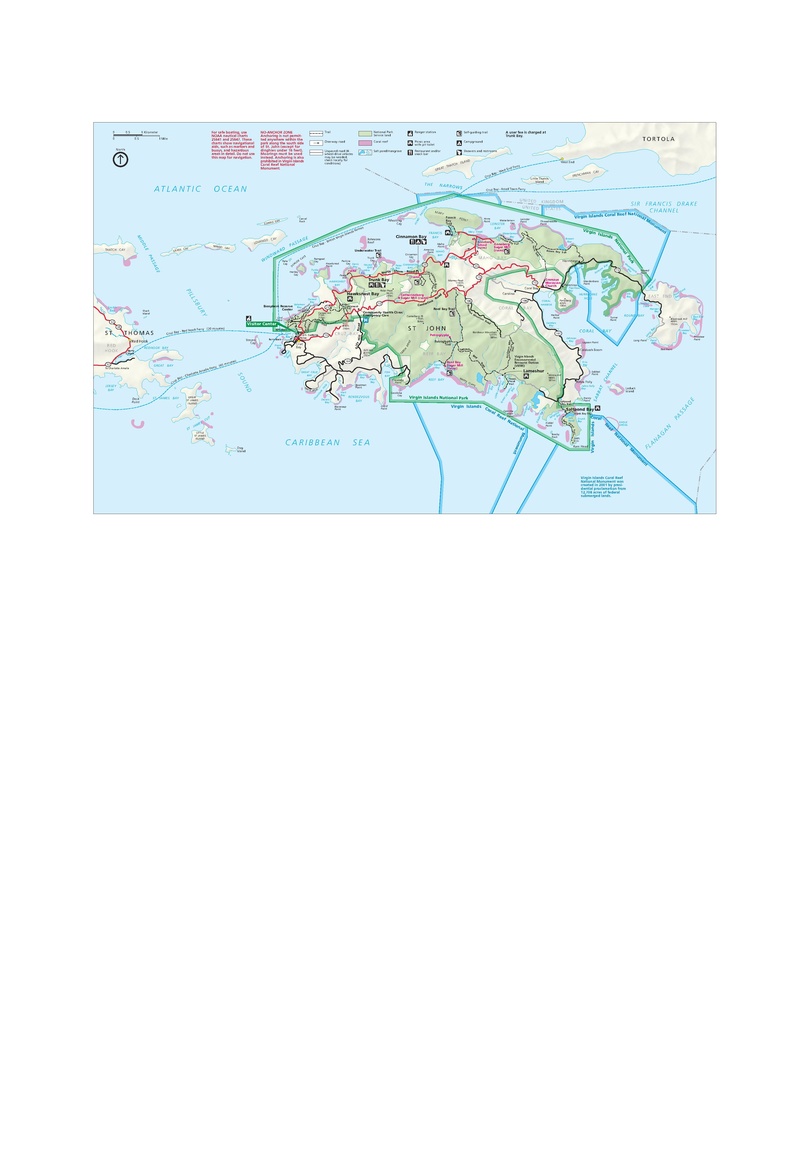
English: Official map of Virgin Islands National Park, including Trunk Bay, Cinnamon Bay, and other locations on St. John. |
| Date | |
| Source | U.S. National Park Service (http://npmaps.com/wp-content/uploads/virgin-islands-map.pdf) |
| Auteur | U.S. National Park Service, restoration/cleanup by Matt Holly |
| Autres versions |
 |
Conditions d’utilisation
| Cette image ou ce document multimédia contient des éléments basés sur une œuvre d'un employé du National Park Service, créé dans le cadre des tâches officielles de cette personne. En tant qu'œuvre du Gouvernement fédéral des États-Unis, une telle œuvre se trouve dans le domaine public aux États-Unis. Voir NPS website et NPS copyright policy pour plus d'informations. |
Historique du fichier
Cliquer sur une date et heure pour voir le fichier tel qu'il était à ce moment-là.
| Date et heure | Vignette | Dimensions | Utilisateur | Commentaire | |
|---|---|---|---|---|---|
| actuel | 17 mai 2017 à 11:50 |  | 2 572 × 1 629 (2,06 Mio) | RKBot | =={{int:filedesc}}== {{Information |description= {{en|1=Official map of Virgin Islands National Park, including Trunk Bay, Cinnamon Bay, and other locations on St. John.}} |date= 2015-08-01 |source= U.S. National Park Service (http://npmaps.com/wp-cont... |
Utilisation du fichier
La page suivante utilise ce fichier :